The wider picture
March is known for wild swings in weather, and this storm follows a severe weather outbreak and record warmth in the central and eastern U.S. A major winter storm named Winter Storm Iona is currently impacting parts of the upper Midwest and Great Lakes, bringing blizzard conditions and record snow. Snowfall has been reported at rates of 1 to 3 inches per hour across portions of Wisconsin and Michigan, creating hazardous travel conditions.
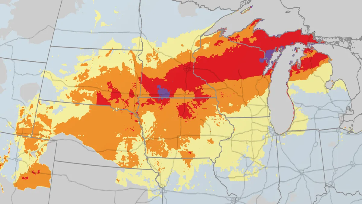
As of now, more than 20 inches of snow has already fallen from southern Minnesota to central Wisconsin, with Marinette, Wisconsin, reporting an impressive 28 inches. Marquette has seen over 214 inches of snow since October 1, making it one of the snowiest locations for that period. The storm is expected to continue, with some areas in the upper Midwest potentially receiving an additional 1 to 3 feet of snow.
Strong winds are also a concern, with gusts expected to reach 40-50 mph in much of the Midwest and East, which could lead to power outages. Residents are advised to prepare for the possibility of downed trees and power lines. In contrast, rain will be the dominant precipitation type along much of the East Coast, where severe thunderstorms with damaging winds are possible from parts of the Northeast to the Carolinas.
Travelers are being urged to reconsider their plans. One official stated, “If you plan to travel in this timeframe in the western Great Lakes and upper Midwest, you should consider either delaying or canceling those plans.” This warning comes as the storm is expected to disrupt travel significantly, with conditions worsening as the storm progresses.
In addition to the snow and wind, some regions may experience subzero lows, particularly in parts of North Dakota, Minnesota, Wisconsin, and Michigan’s Upper Peninsula. Meanwhile, central Florida is bracing for unusually low temperatures, with highs struggling to reach 60 degrees Fahrenheit, potentially marking their coldest St. Patrick’s Day highs on record.
A band of freezing rain and sleet is also possible from parts of extreme northern Iowa and southern Minnesota into southern Wisconsin and Lower Michigan, adding to the hazardous conditions. Observers are closely monitoring the situation, as two-day snowstorm records could be threatened due to the intensity of Winter Storm Iona.
As the storm continues to develop, officials are advising residents to stay informed and prepared. The Weather Channel has been providing updates, and SiriusXM is offering alerts to keep the public aware of changing conditions. Downloading the SiriusXM app is recommended for those who want to stay updated from anywhere.
Details remain unconfirmed regarding the full extent of the storm’s impact, but it is clear that Winter Storm Iona is making its mark across the Midwest and Great Lakes, with significant snowfall and severe weather expected to continue in the coming days.